New features have been introduced to make working with the interactive map even more efficient.
Specifically:
Sectoral Classification by the "Shelters" Parameter
A "Shelters" button now appears in the Sectoral Classifications section of the interactive map. This allows users to find and track projects related to the equipment, construction, or modernization of protective facilities quickly.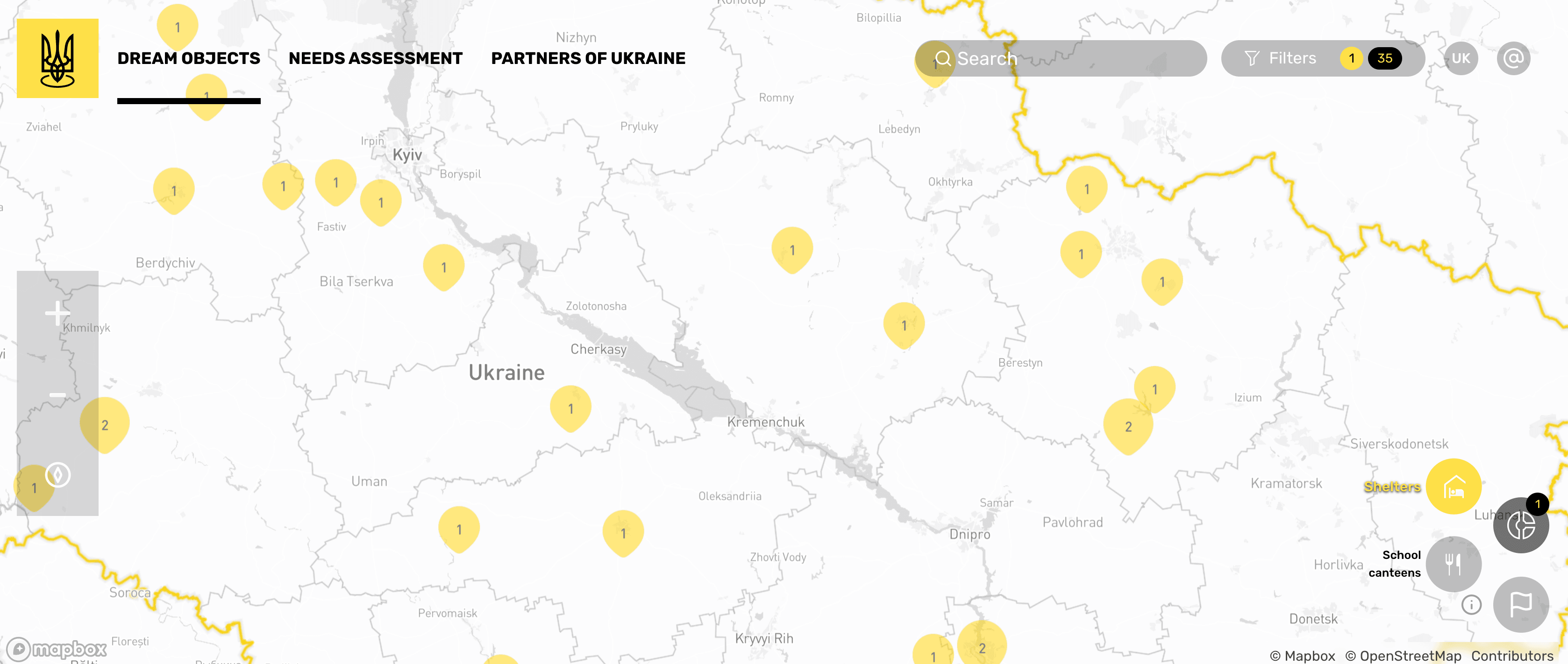
New Filters: "Initiator," "Implementer," and "Project Nature"
Three new parameters have been added to the general list of filters. These enable more precise project searches by the initiator (who started the project), implementer (who is responsible for implementation), and project nature (new construction, reconstruction, modernization, etc.).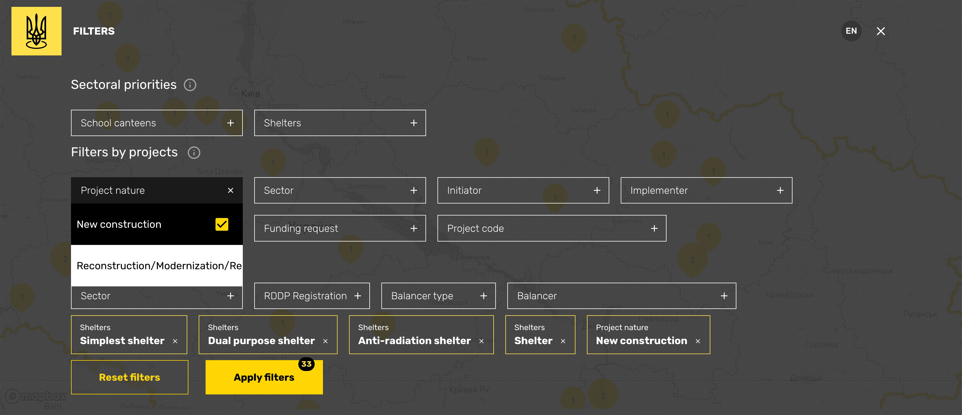
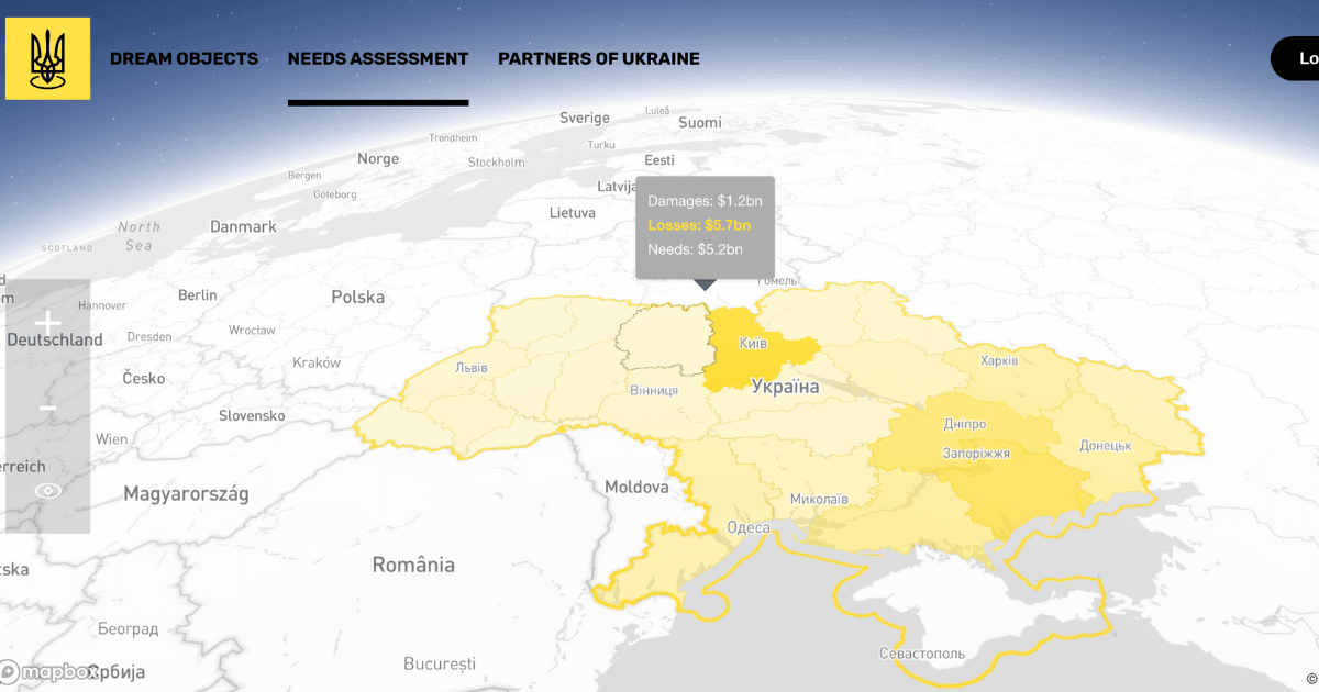
Updated Heatmap Data in the "Needs - Assessment" Section
Information on the scale of damage, financial losses, and needs in each region has been updated according to the latest annual RDNA4 report. Users can monitor and compare this data by region to better understand their dynamics and recovery requirements.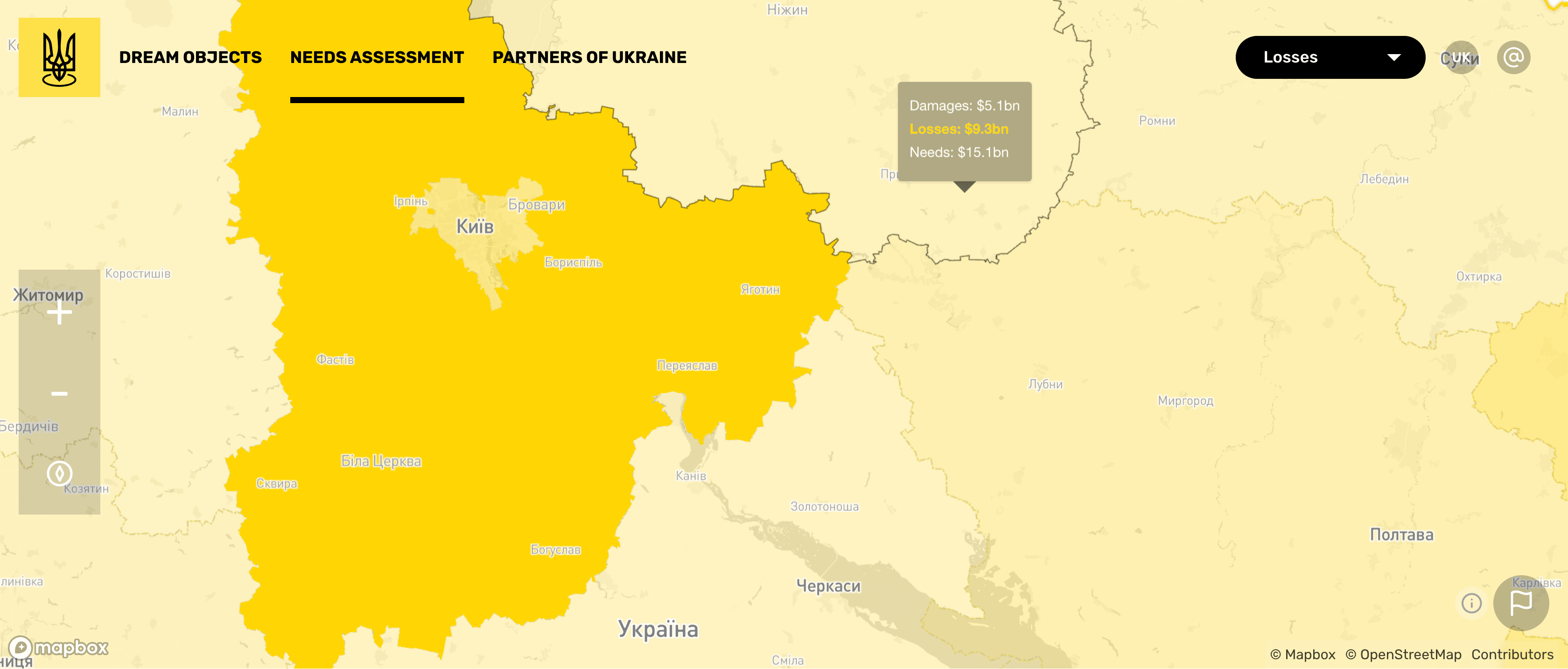
The interactive map is available at: https://map.dream.gov.ua/